.
Here is a link to the interactive expedition map. I've added a number of locations mentioned in this post. They have the camera symbol, but are in blue ("from the air") rather than orange, which marks sites visited on the ground.
Our plane didn't leave until the middle of the afternoon, but hotel check-out time was 11:00.
We decided we'd rather hang out at the airport than avail ourselves of other choices....... (You know you're somewhere weird and distasteful when hanging out at the airport seems more normal and real than your other options!)
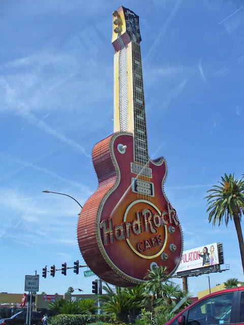
In Reno, giant clowns. In Vegas, giant guitars.
On our way to the airport.
The south end of the strip on the near horizon -- fake Egypt.
Hanging out at the airport. There were comfortable places to sit outside security, and that's what we did, so we could keep our yogurts and other non-security-approved foods.
Adventure sox.
The strip from the airport, as we get ready to go home. Isn't it weird how we had almost this same view from the car on the way to the airport?
Fake Egypt, fake New York ("Empire State building" at right), fake everything. Gack.
So impossibly dry. And yet all these people are busy sucking water down. So totally NOT sustainable.....
Flying east, sitting on the right side of the plane. These pics are looking south, mostly, from here on.
"Lake" Mead. That is the Las Vegas marina, in the highest, right-most part of the water. Why you'd allow power boats in water that is supposed to be for drinking (eventually) I can't understand.
Dry. Dry, dry, dry!
More "Lake" Mead. I believe this is the "Lake" Mead national recreation area. So creepy, for there to be so much water trapped in this unbelievably dry land.
"Lake" Mead goes and goes. I believe that's the South Cove at right, below.
I'm pretty sure I located this on Google maps, but did not find identifying info for it. I've marked it on the Expedition Map as "spotted (1) from the air on the way home".......
Spotted (2) from the air on the way home. The clouds don't help, when trying to figure out where this stuff is. I wish I could get Google maps to show me a "south is up" view -- that would be useful when trying to id pics taken when flying east! I believe I've put the "spotted (2)" marker right on the land feature in the bottom left of this image.
The higher the plane goes, the worse the haze, and the more the color gets distorted when I work at increasing the contrast so we can see *anything*...............
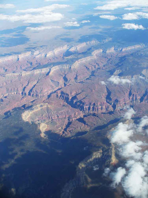
Spotted (3) from the air on the way home. I think the dark part along the left edge of the pic is the western edge of the Kaibab plateau (the north rim of the Grand Canyon is at the south end of the Kaibab plateau). I think I've put a mark on the map about where those clouds are, in the middle of the left side of this image.
There is a four-minute gap between the previous shot and the next one. I bet they served me a drink, or something, and I totally missed seeing the north rim lodge area. Sigh........ This next image is east of the Kaibab plateau.
Spotted (4) from the air on the way home. I feel reasonably confident that I've put a mark on the Expedition Map right on that snake-head sort of piece of land, pointing at the middle of the left edge of the next image.
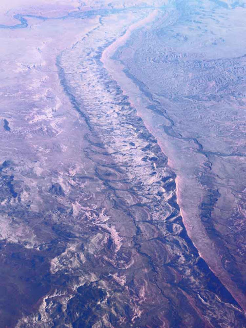
Spotted (5) from the air on the way home. I believe I've put a marker on the map at the lower left corner of the next image, just above the river. We can't see the river, but the Colorado River is carving the dark canyon that meanders from lower left to center right. I don't know if this is technically part of the Grand Canyon or not. (Notice snake-head thing from prev, at right edge of the next one.)
Spotted (6) from the air on the way home. Part of "Lake" Powell. I believe I have put a marker on the map just above the center bottom of the next image.
Spotted (7) from the air on the way home. I am pretty confident that I've placed a marker on the dark plateau in the lower right corner.
Spotted (8) from the air on the way home. I believe I have placed a marker on the spot on the map that is just above the lower right corner of this image. (I love Google maps..........)
Spotted (9) from the air on the way home. Part of the San Juan river, which becomes part of "Lake" Powell.
Spotted (10) from the air on the way home. I believe I've put a mark on the map near the spot in the lower right of the next image. The river in the top left corner is the San Juan.
Spotted (11) from the air on the way home. Some marks on the land are really easy to recognize. Those black shapes........... That's the San Juan river, running across the top.
Zoomed as far in as one can zoom, in Google maps. The dark spots surely look blacked out, here. But they look blacked out in my pic, above, too. Wonder what's really going on here! Some sort of horrible thing, I suspect....................
I think this is the Dolores river. I believe we have crossed over the border into Colorado. Spotted (12) from the air on the way home. I think I have put a mark on the map near the middle bottom of this image.
Spotted (13) from the air on the way home. I am much less confident that I found the right spot for this one. Perhaps the (13) mark on the map is just below the snowy bits near the bottom of the image.
I have no idea where this is, but it's between the prev and the one that follows.
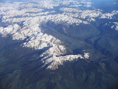
Given our trajectory (from the locations of all the pics), I am pretty confident that I have placed a marker on the map just this side of the rightmost "finger" in this "hand" of mountains.
The previous pics were taken from 1-6 minutes apart. This one was 45 minutes after the previous one. From the trajectory, this is either Kansas or Nebraska. When I look at Nebraska on Google maps, there are A LOT of irrigation circles. A LOT. Not so many in Kansas. So -- I have no idea.
The whiter lines of dashes running across this image are windmills. I hope that's good. (Not too many birds hit by the blades, or whatever.......)
This one was taken 35 minutes after the previous. It was getting cloudy, and then it got dark.
The last pic from a spectacular expedition. What a great trip.
Huge thanks to our daughter for organizing all of this for us. That was a LOT of work, and we are grateful.
I forgot to say, when I wrote about our outbound flight, that I watched the movie Hidden Figures on the plane. I recommend it highly. Those women made it possible for our space program to fly. And they were treated like dirt. I am so glad that at least some of them are now being honored as they should have been all along. I am ashamed of the way we white people benefited back then, and the way too many of us continue to feel we ought to benefit now, because of the skin we happen to have been born with. We have a lot of fixing to do before there is justice for all.
Here is a link to some Google maps images of landscape right near the Grand Canyon. So incredible what we can see in Google maps.............
.
Subscribe to:
Post Comments (Atom)














No comments:
Post a Comment